From the main dashboard navigate to the Maps & Charts module and then the Mapping & Navigation tool. 1) In the top left corner of the main maps overview are 4 different icons. The second from the top, the marker tool, is used to create a new waypoint.
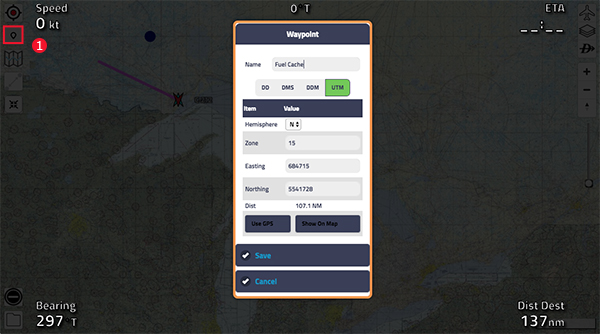
Once you’ve selected the marker tool, you should notice your mouse cursor has changed to a crosshair once it’s hovered over the map. Click anywhere to create a new waypoint. From here, 2) click the direct to tool, the third icon on the right hand side of the map that looks like a capital D with an arrow through it.
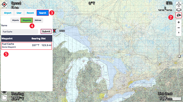
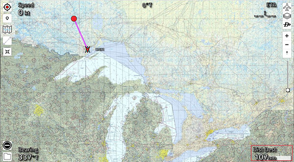
From the new prompt on the left side of the screen, 3) click on the search tab at the top and then click on 4) waypoints. From here, search the waypoint that your looking for. 5) Once clicked on, a line will be drawn from your current location to the waypoint, with the distance down in the right hand corner.
Deleting A Waypoint
To delete a waypoint simply click on the waypoint you wish to delete. This will open a prompt with a button to delete near the bottom. Click the delete button to remove the waypoint.