Cirro’s mapping and navigation module has some handy fire options that you can toggle on to display fire weather and fire behaviour information. To activate, open the layers menu and scroll down to the fire forecast option.
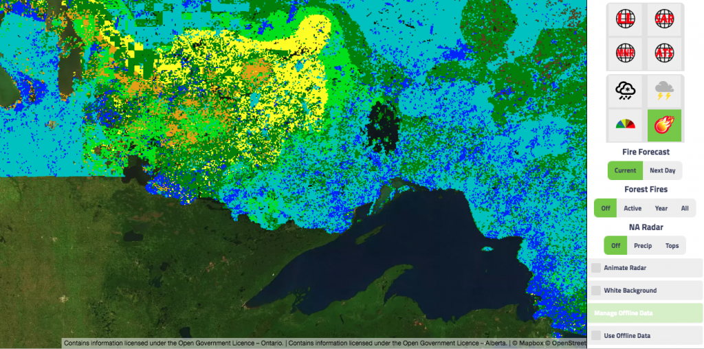
You will notice two icons, fire danger ![]() and fire intensity
and fire intensity ![]() . Fire danger is a relative index of how easy it is to ignite vegetation, how difficult a fire may be to control, and how much damage a fire may do. The legend for the different colours is:
. Fire danger is a relative index of how easy it is to ignite vegetation, how difficult a fire may be to control, and how much damage a fire may do. The legend for the different colours is:
Low Fires (Blue) – likely to be self-extinguishing and new ignitions unlikely. Any existing fires limited to smouldering in deep, drier layers.
Moderate Creeping (Green) or gentle surface fires – Fires easily contained by ground crews with pumps and hand tools.
High (Yellow) – Moderate to vigorous surface fire with intermittent crown involvement. Challenging for ground crews to handle; heavy equipment (bulldozers, tanker trucks, aircraft) often required to contain fire.
Very High (Orange) – High-intensity fire with partial to full crown involvement. Head fire conditions beyond the ability of ground crews; air attack with retardant required to effectively attack fire’s head.
Extreme (Red) – Fast-spreading, high-intensity crown fire. Very difficult to control. Suppression actions limited to flanks, with only indirect actions possible against the fire’s head.
The fire intensity icon displays the predicted intensity, or energy output, of the fire at the front or head of the fire. It has become one of the standard gauges by which fire managers estimate the difficulty of controlling a fire and select appropriate suppression methods. It is measured in kilowatts per metre of fire front and is based on the Rate of Spread and the Total Fuel Consumption.
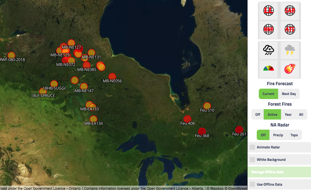
Another useful feature is the option to toggle on active forest fires. All fires are represented by a circle icon and its unique identifier. If you click on a particular icon it will open up and present additional information such as size, cause, and current status.